Growing up in Ohio, we were accustomed to steel bridges that crossed the Ohio River and other smaller rivers in the area. It seemed like most country roads had bridges of one size or another at one point. In the 1970's, my parents started taking our family on Sunday road trips. We drove through state forests and small towns, climbing fire towers and crossing bridges that seemed ancient. Eventually, I got married and stopped going with them each week. One of the trips they took after I got married was to a bridge over the New River Gorge in West Virginia. Their experience didn't really mean much to me at the time; but, moving to Texas and seeing what they call rivers and bridges in this state, gave me a new appreciation for the vast power of rivers in the Appalachian area, and the efforts of engineering put into crossing them.
When we planned this trip, I noticed how close our campsite was to the New River Gorge. I figured we had the time and were in the area, so why not plan a day trip. It would only be about a 2 hour drive from Argillite; and it would give us a chance to mark off another National Park/Monument/Site.
I don't have nearly as many pictures as I would have liked. Ron isn't able to see very well; and, having never been the family photographer, he doesn't even think about taking pictures. Since I'm doing all of the driving, by the time I ask him to take a picture of something we see, the site is already passed. Hopefully, he'll be driving again some day.
That being said, here is what I managed to get at roadside stops through the gorge.
 |
| The first place we stopped was Kanawha Falls, at a local fishing area. The river flows along US 60 in West Virginia. The falls spread across the width of the river. They are only 15 ft. high, but still quite impressive. |
 |
| One of the prettiest towns we drove through was Gauley. I looked up information about the town when we got back to camp and discovered it is known for white water rafting. It is located at the convergence of the Gauley and New River, which forms the mouth of the Kanawha River. |
 |
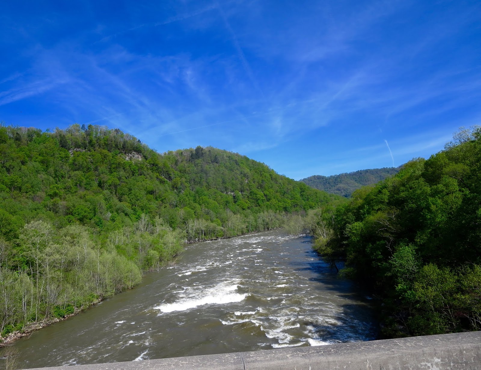
| We drove across the lower section of the New River. In this area, it is still relative narrow and slow moving; with a few rocky area that also provide great white water rafting trips. |
 |
| As we drove through the gorge, we passed several waterfalls. I hadn't realized there were so many in this area. I read about them at the visitor's center and have tried to remember their names. I believe this one is Laurel Creek Falls. It's a seasonal waterfall and depending upon rainfall amount, it can be between 10 and 25 feet high. |
 |
The visitor's center is really small but had nice displays. I actually took several pictures, but
when I looked at them, I realized I had a huge scratch on my camera lens!! Many of my pictures had hazy distortions right in the middle of them and I couldn't use them. The visitor's center told the history of the gorge, the impact of the coal industry on the surrounding area, and about
how tourism has increased with the interest in white water rafting and rock climbing. |
 |
| This is a picture of the bridge that spans New River Gorge. Before the bridge was built in 1977, it took people 40 minutes to drive down one side of the gorge, cross the river, and then drive up the other side. After the bridge was built, it only took 1 minute to drive across. The original roads still are used but we decided our truck was just too long and huge to be driving a road with so many switchbacks |
 |
| The visitor's center has large, enclosed seating areas that look out over the river. We were there in the spring, so the trees weren't completely leafed out. I don't imagine the view will be as unobstructed once they do. But, there is a walking path that goes out to a hillside deck with excellent observations points to see the actual bridge. |
 |
| Coming back down the mountain, into the lower portion of the gorge, gave us a chance to see another waterfall. This one is called Cathedral Falls and is one of the highest and most scenic in West Virginia. It is estimated to be 60 feet tall most of the year. Once again, the size of the fall is dependent upon rainfall and snow melt. There is a parking area and a path that lead back to the falls. It was a relatively easy walk, less than 5 minutes. Ron was waiting for me at the parking lot so I didn't stay long. It was really peaceful, with the sound of the fall and the birds in the trees. I would have loved to stay longer. |
 |
| Another view of Cathedral Falls, from the walking path. |
When we got back to Texas, I told Scott that he really needs to get his fire fighter friends together and take a trip to the area. They would absolutely love the outdoor activities.


No comments:
Post a Comment